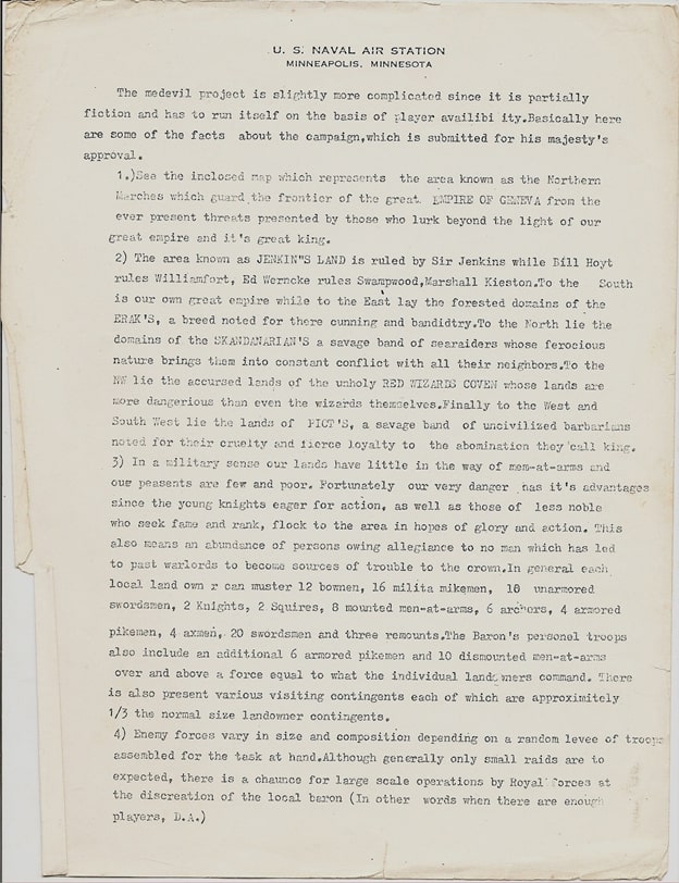
Watching one of Dyson Logos’s time-lapse videos is mesmerizing. Finger tips squeeze close to nib. Black ink trails as the pen glides along straight lines, jerks through hatch marks. Parallel lines become a long corridor, a protruding rectangle a door frame. Rubble strews across the floor.
Then the hatching. Short, quick strokes: one, two, three—one, two, three… That’s when we know: this guy’s wired different.
There’s a thing about a Dyson Logos dungeon map. By the hatching we recognize the style, because we’ve been admiring his work for more than a decade. But it ain’t the hatching.
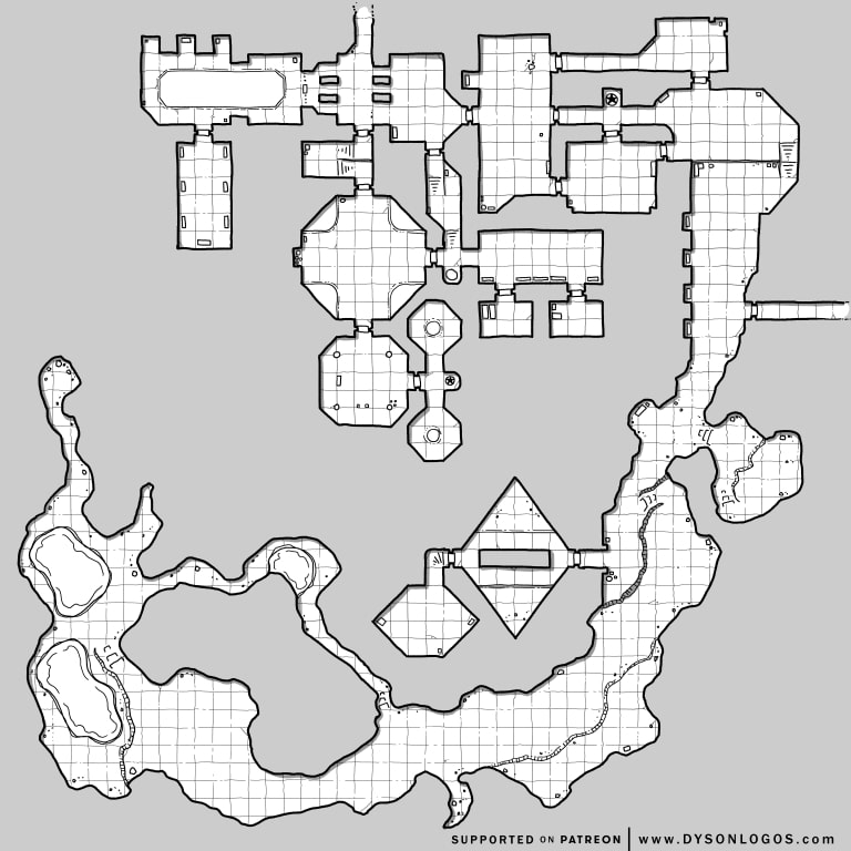
The tripartite doorways either side of the entry hall, middle north, a blind stairway landing just south of it, rounded triangular daises in an octagonal room, a balcony overlooking half a chamber, stairs to the side, the generous use of dungeon furnishings—these catch the eye and draw us in.
But there’s more. Charting an imagined course through the dungeon, we follow branches, turn around at dead ends, weave one way or another along parallel routes, until we progress, via a wide thoroughfare, into the southern caverns.
This long trench reminds of a dry watercourse, perhaps a former Darkling tributary, which leads us to the dungeon’s end, where we find only stones and dry bones and lurking creatures. For we’ve missed the diamond-shaped central chambers where its priests work to repair “The Shrouded Emperor.”
That’s the thing about a Dyson Logos dungeon map.
Dyson Logos has been creating hand-drawn maps for fantasy role-playing games since 2009. You can support the creator on Patreon.
As it is the dragon’s ingress to the subterranean domain he wishes to subjugate, the Throrgrmir Citadel is the focus of the Valormr Campaign. The campaign begins with the dragon’s raid on the citadel’s ramparts. The Chaos Armies invest its upper works throughout the war, which reaches a climax when the Forces of Law arrive to besiege the besiegers.
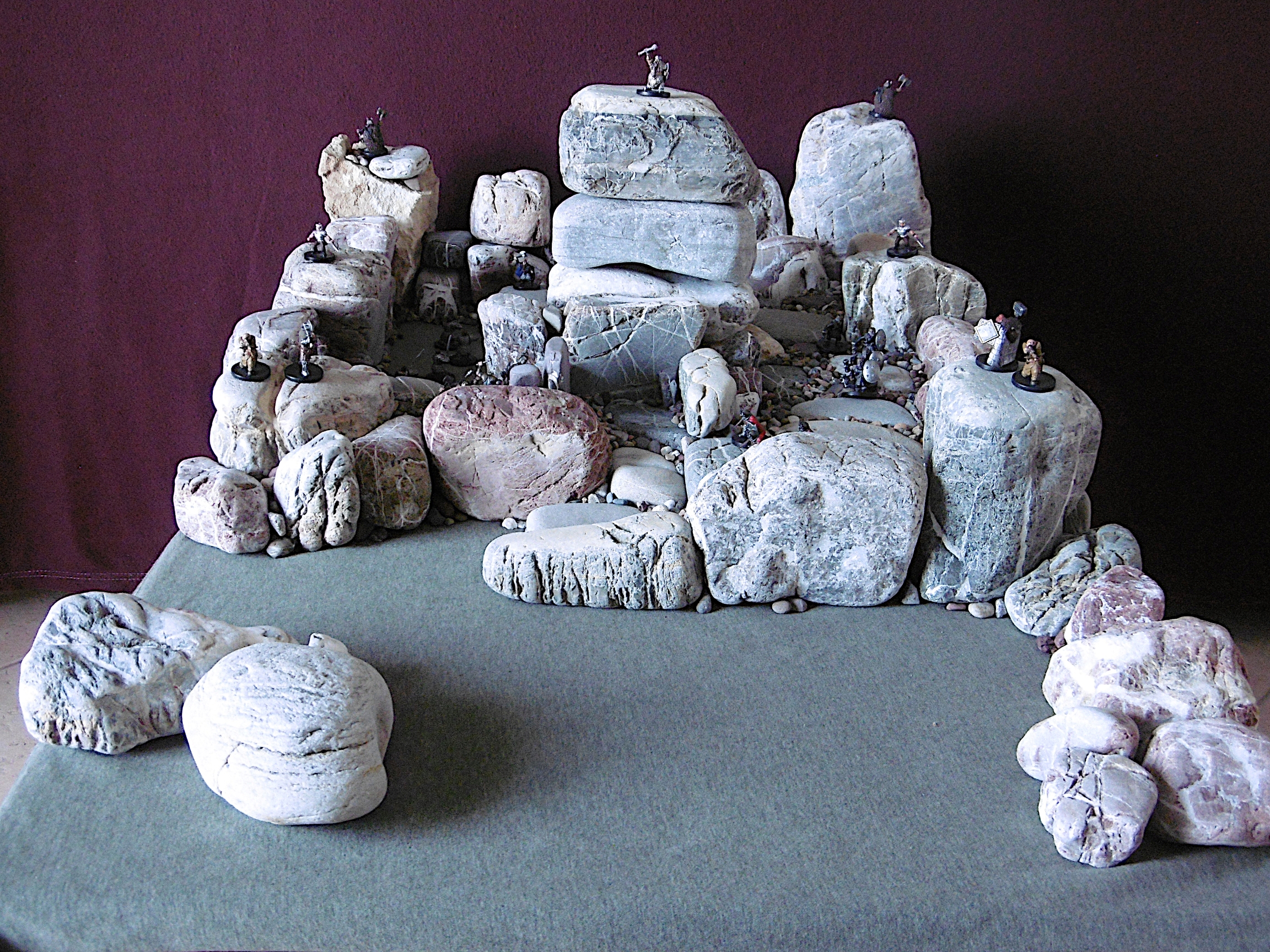
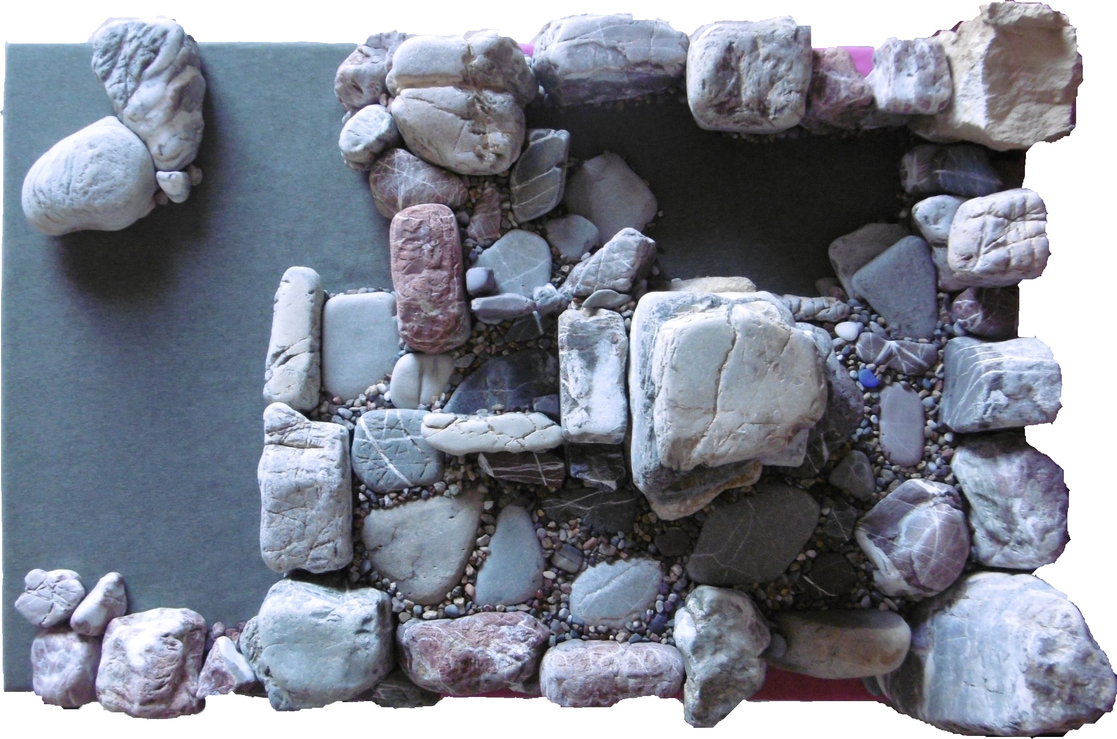
An autumn breeze at our backs, we climb a steady slope to the top of a rocky plateau. The noonday sun hovers above crenellations, like a crown before the moment of coronation. We approach the Throrgrmir Citadel from the south. Its forward parapets, 20 feet high, stretch between 25-foot corner towers, anchored into rock either side of the plateau. Bearing a stone marked by the rune of welcome, which serves as our invitation, we mount the entry stair, stepping east then north again before facing west at a massive gate carved from a granite block.
Showing the invitation and speaking the name Fjoldi Funderburk, for he is to be our host, the gate opens to us. We pass between drystone walls, mosaics of stones. Each stone is defined by a thin seem without mortar. We are greeted by a dwarf with a broad smile of large teeth like ivory squares. Fjoldi is our old friend and adventuring companion. His beard has a few more gray whiskers than the last time we saw him, and in place of a battle axe, he now carries the amulet of an administrator. But his green eyes flash at us when he makes short jokes about dwarven stature and human life spans.
After warm embraces, Fjoldi offers a tour of the citadel, which we readily accept. From the entry yard, we turn north, descending a few steps into a garden courtyard. We walk on stone paths through lush grasses amid wildflowers and fruit trees, bosquets of hydrangea, pink and blue, and round alyssum shrubs, snowy white. Their honey fragrance fills our nostrils.
On our right, the central donjon rises into a clear cerulean sky. Reaching into a low branch, Fjoldi pulls fruit and puts apples into our hands. “Crunch on that,” he says, “to take the edge off your journey’s hunger. Soon, you will feast at Harbard’s table,1 but first you must gird your strength for climbing stairs.” Here he raises an arm toward the donjon’s height, “For the tour ends with a view of the valley.”
“The tower’s base is twenty-five feet square,” he continues, “and it’s fifty feet high. Men build no higher. They say it won’t stand. But I’ll show you different in the city below. In Throrgardr, you will stand atop a tower that is in height three times its base width.”2
At the far end of the Greensward, as Fjoldi names it, we ascend another stair to the Stonesward. There, in the donjon’s north wall is set a great door of granite, like the gate, and even more massive. Etched upon its face, runes welcome friends and warn enemies.
Our host halts at the stair top. Between us and the door, set among floor stones, is a thick plate of blue glass. It gleams in the sunlight. Made from a large chunk of crystal discovered in caverns far below our feet, Fjoldi explains, it is the Throrgrmir Stone. “Dwarves kneel to kiss it when returning from a long journey. The stone brings blessings upon us, and it bestows curses upon enemies who step beyond it.”
Farther along, we come to a fountain set in the northeast corner. Water spouts from the mouth of a boar’s head. The sculpted stone is painted the same blue as the gleaming glass. Sapphire eyes look through a silver mask. Unless we hail from the world’s distant ends, we know that Throrgrmir means “masked boar,” and only the incurious are ignorant of the dwarven civilization’s founding by a forefather of that name.
As we progress now south, ever the donjon towering above, we pass along a wide, flat stone pavement between turrets and parapets. Fjoldi informs us that the unused fountain water drains into a cistern below the citadel. We are then encouraged to examine the smooth floor upon which we stand. Our human eyes cannot discern the Stonesward’s gentle slope from south to north and from east to west. Rainwater, he tells us, drains from tower tops and parapets and from interior courtyards into the cistern.
We now approach the Stonesward’s south end. Turning west, we find ourselves on a balcony, overlooking the broad stair by which we arrived. Fjoldi leaps to the balustrade and, in a few words, paints a picture. Dwarf maidens and children gather here to welcome foreign dignitaries, he tells us. The maids wear white silk dresses and crowns of pink flowers. “They dance with long blue sashes,” he says, twirling around his raised arm. “The children toss alyssum flowers at the guests’ feet, and the air is filled with their sweet aroma.” Fjoldi stops dancing. “And enemies are welcomed by dwarf crossbows.”
Finally, we climb the interior stairs to the donjon’s battlements. The view extends for miles and miles in all directions. The sun warms our cheeks, the breeze blows into our faces as we gaze across the forested valley. The autumn woods are a blanket of orange and gold.
“Look to the sky, my friends,” says Fjoldi. “Twice this year, we’ve seen a dragon.”
Notes
1 Our host refers to Dwarf King Harbard V. Our visit to the citadel is a few weeks prior to events of the Valormr Campaign.
2 Fjoldi speaks no dwarven cockalorum. Exploring the ruins of that legendary city, adventurers in the time of Wyrmwyrd may discover a tower, 70 feet high on a 20-foot base. The “Impossible Tower,” as it is called, yet stands after thousands of years. As Throrgardr was the subject of my first beach stone tabletop construction, I have pictures.
3 The Throrgrmir Citadel’s size is comparable to that of the model Bodenburg Castle. Henry Bodenstedt’s rules for “Siege of Bodenburg” (1967) show the castle on a 20-by-20-inch plate. I don’t see reference in the rules, but by rough measurements made from photographs, I estimate the keep’s height at about 12 inches. Throrgrmir, though, is less portable.
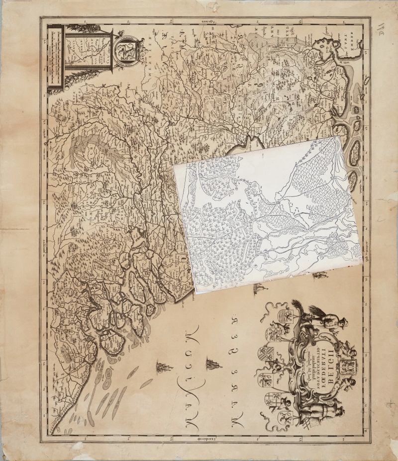
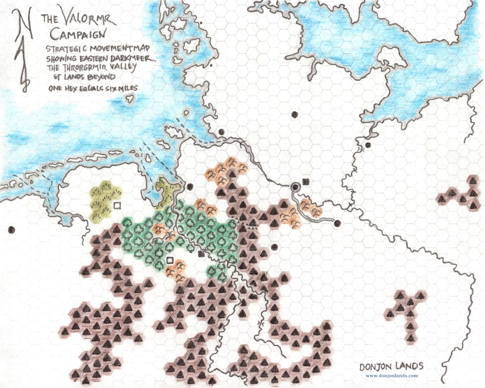
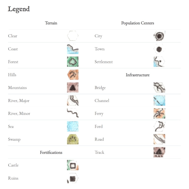
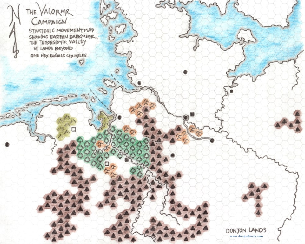
With the strategic movement rules almost ready, I added a few refinements to the Valormr Campaign Strategic Movement Map: two towns, cataracts, fords, a ferry, and a bridge. I updated the map in the original article. I also appended a legend. The map in higher resolutions, 100, 300, and 600 dpi, is available on the Downloads page.
Some thousands of years prior to the beginning of Wyrmwyrd, the Throrgrmir dwarves defended their subterranean civilization against the red dragon Anax Archondas.
While in Viggo Eskilsson’s day, we refer to the battle as Valormr, at the time it was known as the Battle of Throrgrmir. Later historians would call it the Second Wyrm War. The first was the Battle of Throrgardr.
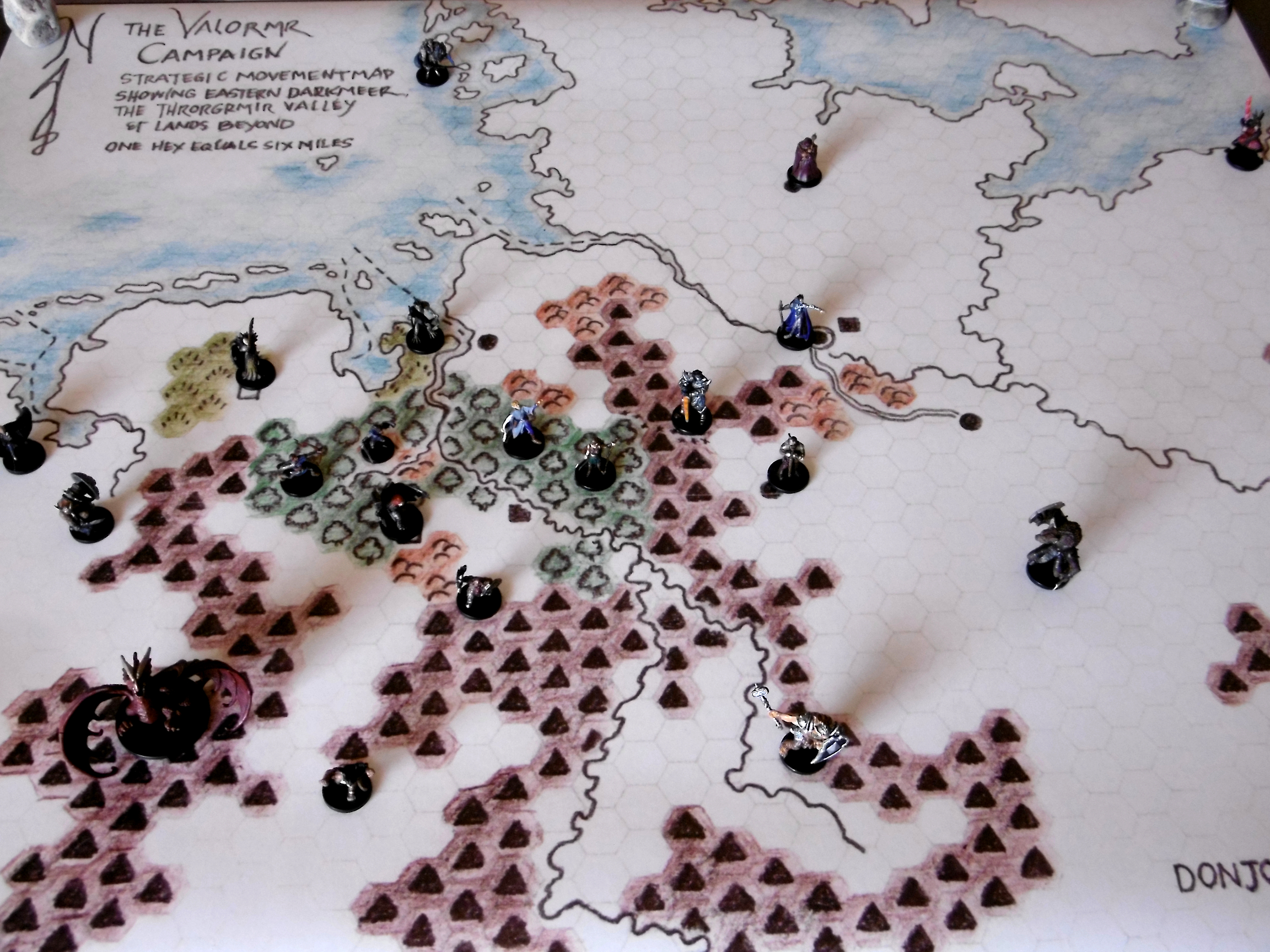
In the Valormr Campaign, we simulate events and engagements leading up to the Battle of Throrgrmir and the battle itself.
Legend
Terrain
Population Centers
Clear
City
Coast
Town
Forest
Settlement
Hills
Infrastructure
Mountains
Bridge
River, Major
Channel
River, Minor
Ferry
Sea
Ford
Swamp
Road
Fortifications
Track
Castle
Ruins
To the strategic map, I added two towns, cataracts, fords, a ferry, and a bridge. The map image at top is updated. In addition, I appended a legend to this article. The map in higher resolutions, 100, 300, and 600 dpi, is available on the Downloads page. [08:10 15 August 2021 GMT]
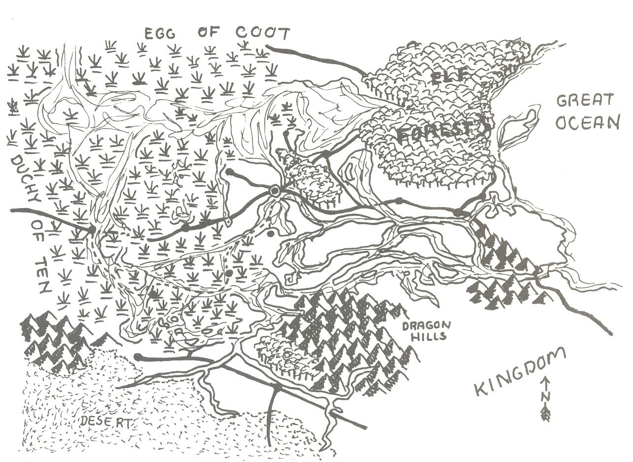
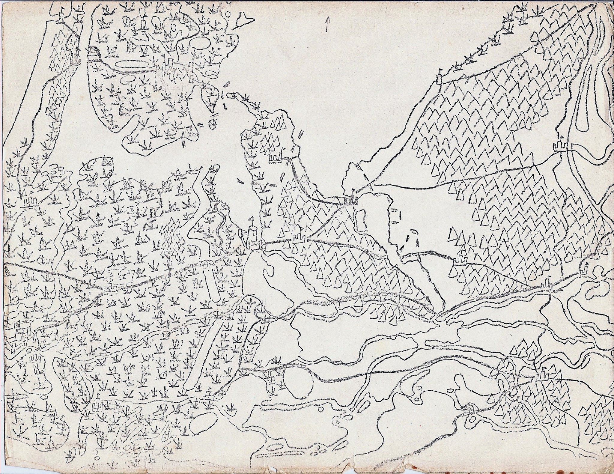
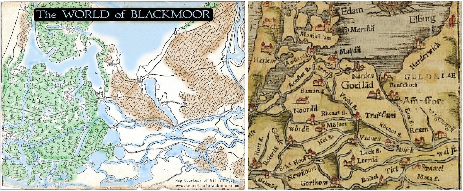
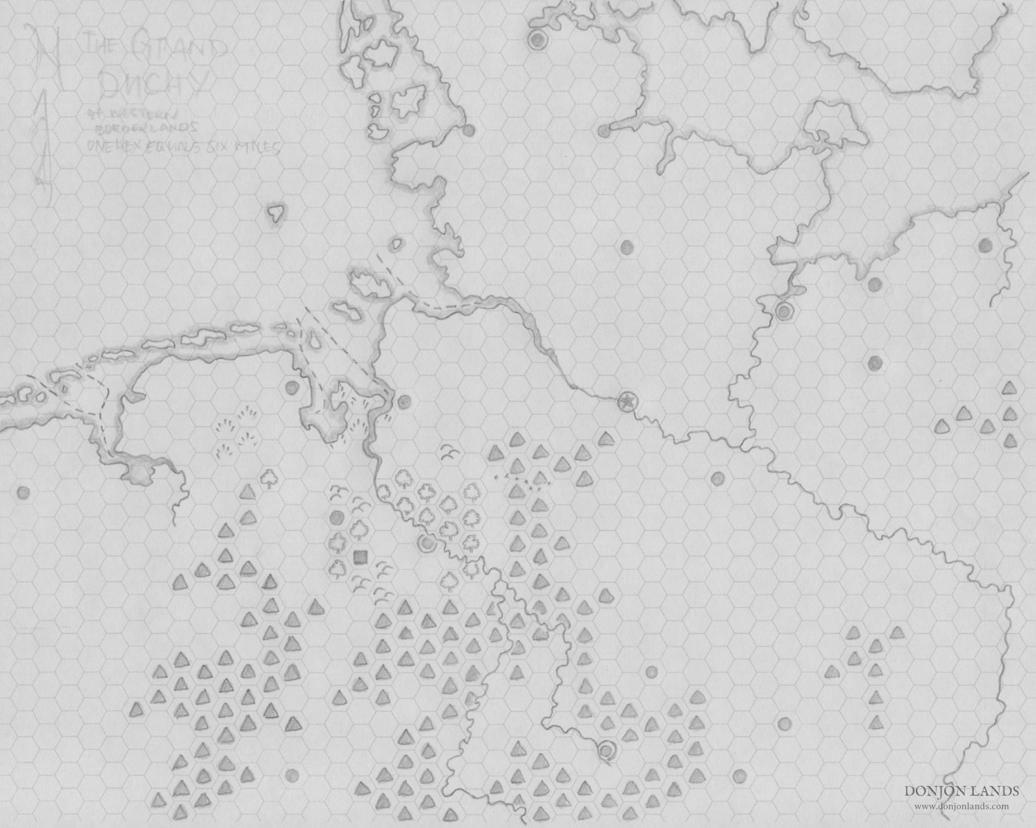
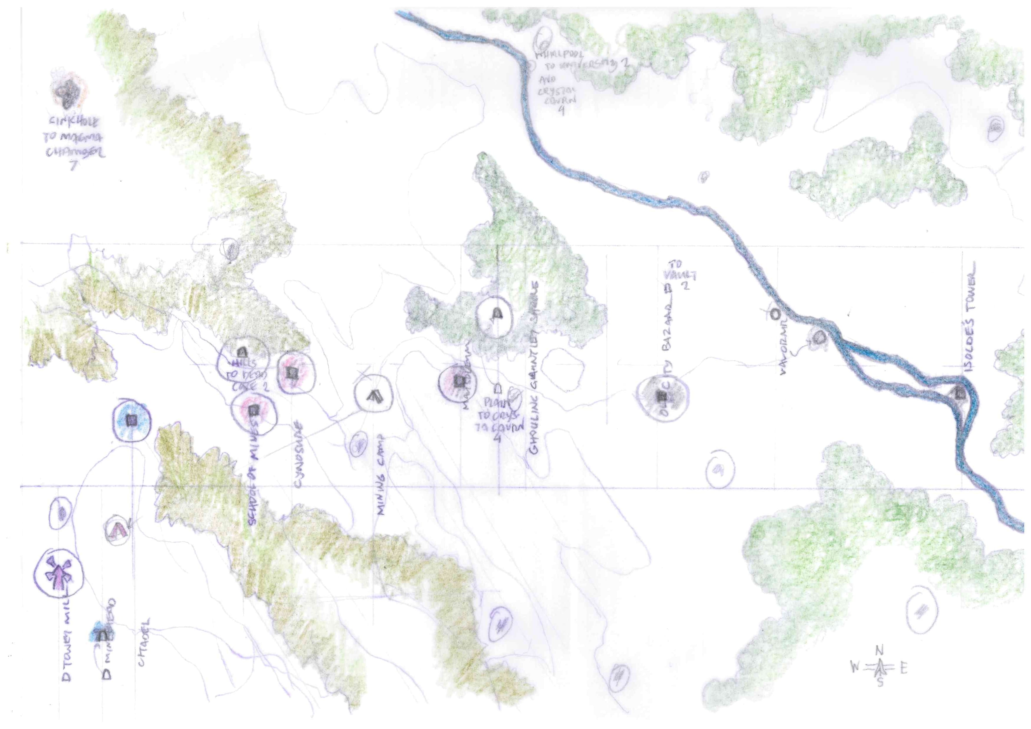
Another preliminary map. At such an early stage—that is, before the first door is forced open—it is premature to consider the wilderness outside our immediate adventure area. My purpose, with regards to Wyrmwyrd, is to show the greater area, however generally, in which events play out. Furthermore, the base, modified, serves as the strategic-level map for the Valormr Campaign, which takes place a few thousand years prior to Wyrmwyrd.
In my childhood experience with wilderness maps, I first loved to make mountains. Later, I loved to do forests, then hills. Now I love to make rivers!
The north-south river right of center is in fact a canal, built by the Greater Ones, repaired several times since the Rending.
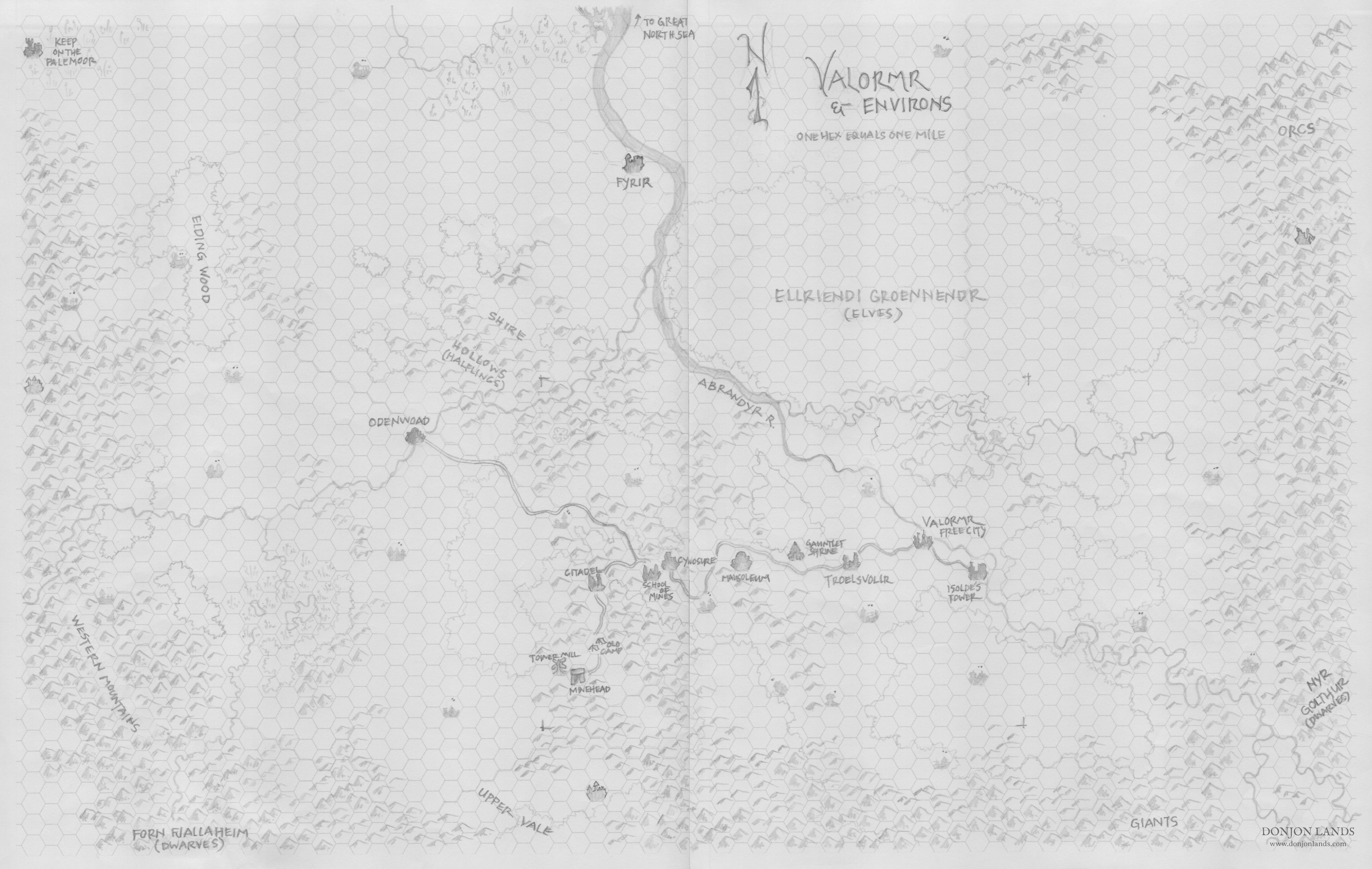
In preliminary form, this pencil sketch serves as the local area map for initial adventures in the Wyrmwyrd campaign. At lower character levels, most of our adventures will be in the dungeons. I save feature names, color, and maybe ink for future work.
As the campaign progresses, I will further elaborate the following text. I expect to borrow from Viggo Eskilsson, who must be writing a geography to accompany his Histories.1 For now I note only key points necessary to get the campaign started.
The scale being one mile to the hex, I use the large icons for map terrain (X62). The pencil’s lightness and my drawing skill render some icons difficult to differentiate. As a guide, the only city is Valormr, the only towns Troelsvollr and Odenwoad. Villages I mark with two dots in the hex. Smaller hamlets and thorps, only one. Castles and ruins are more heavily outlined.
The Valormr-Odenwoad road is shown, as is the road to the Citadel and Mine Head, which is in disrepair. Not shown are cart tracks between villages.
Dungeon Below
Right-angle markers (right and below center) frame a rectangle corresponding to the area above the Throrgrmir dungeon. See the Level 1: Surface map in “Dungeon Overhead by Strata”.
Valormr, Free City
Population 12,000.
Governed by a council of Lords, which elects each year one of their number to serve as Lord Mayor.
Principle holdings include Odenwoad (west) and Fyrir (north).
The domain of Valormr serves as a borderland between the Grand Duchy (off map) to the east and the fearsome lands of Darkmeer beyond the Western Mountains.
The city trades up and down the river and with the Grand Duchy.
Abrandyr River
Navigable south to Arvohne (city, off map).
Empties into the Great North Sea at Skullhaven (former pirate hold, off map).
River Travel
From Valormr, riverboats travel upstream to Arvohne in three days and downstream to Skullhaven at the river’s mouth in two days. From Skullhaven east along the coast and up another river to the capital and major trade port of the Grand Duchy, four more days are required. Aboard a mercantile vessel, the journey takes from two to three times longer, allowing for stops at trading ports.
A frequent trading stop—often a destination—for law-abiding merchants and for those who can temporarily abide the law. Since the Red Ogre opened a tunnel from the dungeon below, monstrous races frequent the bazaar. A special detachment of the Valormr Guard patrols the stands, booths, and tents in force.
Odenwoad
Small town, population 4,000.
The High Castle of Odenwoad overlooks the town and river.
From the High Castle, the Lord of Odenwoad governs the town and surrounding villages.
Patrols range from the Shire Hollows to the Western Mountains,2 from Elding Wood to Upper Vale.2
Fyrir
This fortress guards the domain against pirates.
Also patrols north of the Shire Hollows and, across the river, north of Ellriendi.
Shire Hollows
Total population two thousand halflings.3
Numerous streams flow from rolling hills, through farms and woodlands.
Divided into three shires: Arbenshire (also called North Shire), Black Pine Shire (east), and Gold Hollow (or South Shire).
PC Origins
As the campaign begins in the remote area northwest of Odenwoad, player characters of human classes hail from villages in that region. Demihumans come from one of their respective communities: halflings from the Shire Hollows, dwarves from Nyr Golthur or Forn Fjallaheim, and elves from Ellriendi.
Ellriendi Groennendr
Elven population unknown.
The elves defend the forest at all costs.
Orcs from the mountains are a frequent threat.
Only elves and elf friends are allowed to enter their territory.
The forest today is a fraction of its size in ancient days.
Deep within the forest, the elves guard a secret.
Players, Characters, and the Secret of Ellriendi
While an elven character may know Ellriendi’s secret, the player does not. Bound to silence, the character will not talk about it or answer any questions concerning the secret. The player, though ignorant, may run the elf as evasive, aloof, and enigmatic as desired.
Forn Fjallaheim
During Throrgrmir’s decline, four dwarven clans migrated from the dungeon, each on separate occasions.
Two clans returned to Fjallaheim, their mountain home.
A third clan resettled elsewhere to an as-yet-undetermined location on the map.4
From the fourth clan, we have no word since their departure southward.
Nyr Golthur
At the fall of the Throrgrmir civilization, the five remaining clans emigrated to the mountains up the Abrandyr.
They mine silver and dispute the river valley with giants.
Refer to themselves still as Throrgrmir dwarves.
Pale Moor
Between the Western Mountains and the Great North Sea, these lowlands are shrouded in mist and legend.
Wise folk don’t go there. The foolhardy don’t return.
Notes
1 A geography in the style of Strabo’s Geographica but constrained to the local area.
2 The Western Mountains and Upper Vale are parenthetical names. That is, they are often referred to as such, but they also have proper names I haven’t learned yet.
3 I calculate 2 to 5 villages per shire (average 3.5) times three shires, which makes 10.5 villages. Per village, populations range from 30 to 300 (average 165). I round up from 1,732 (10.5 x 165) to 2,000.
4 We allow campaign events to determine the third dwarven clan’s present location.
“Though not more than a thousand feet deep, Throrgrmir is a vast underground realm. Its eight major levels split into numerous sub-levels and spread across an area of at least five hundred square miles.1 Civilizations have dawned and died within its depths; empires built and crumbled over the long ages of its existence.”
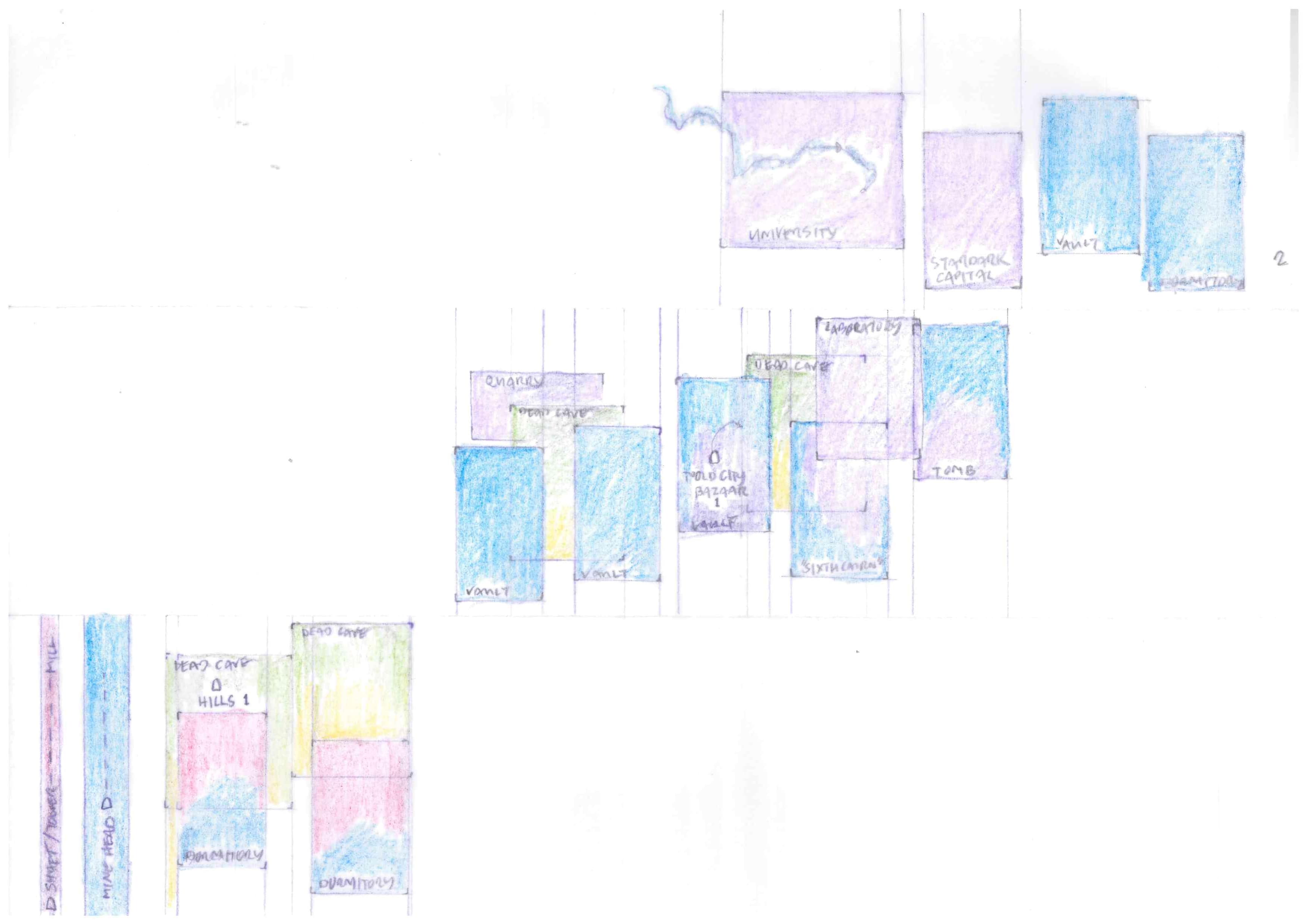
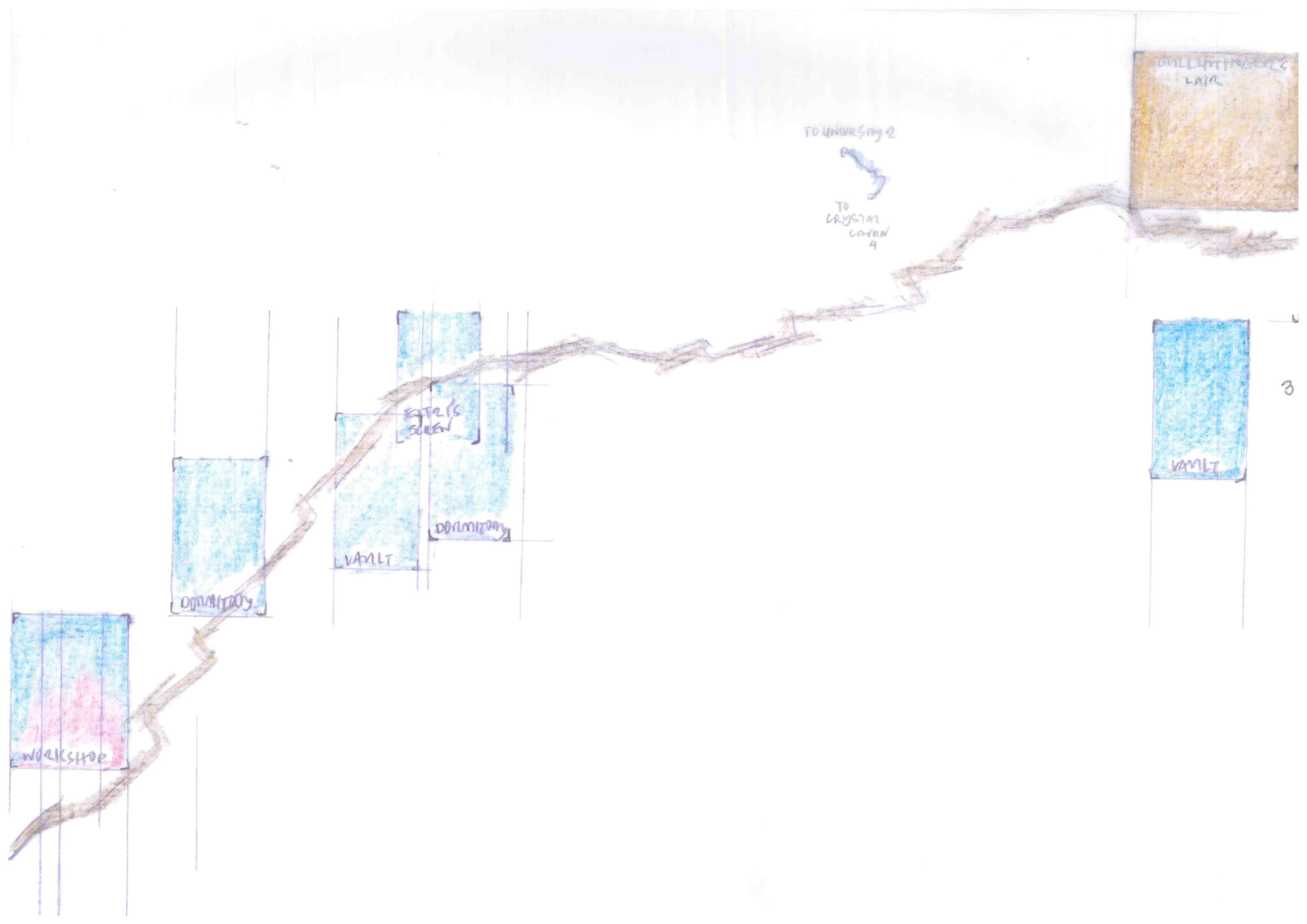
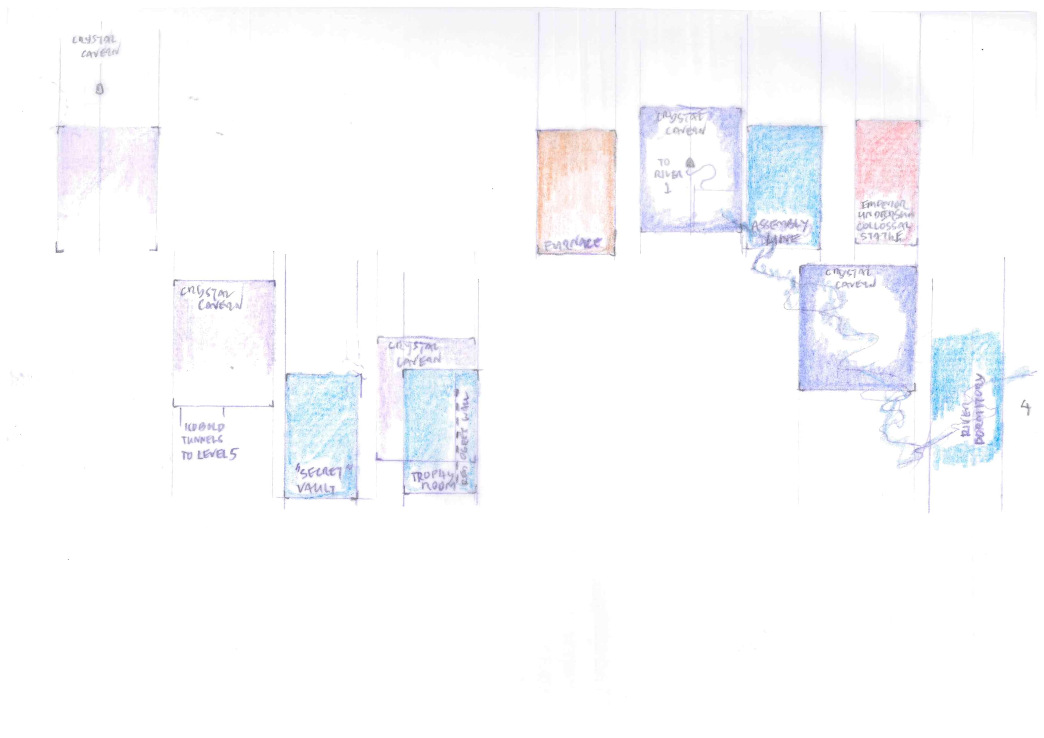
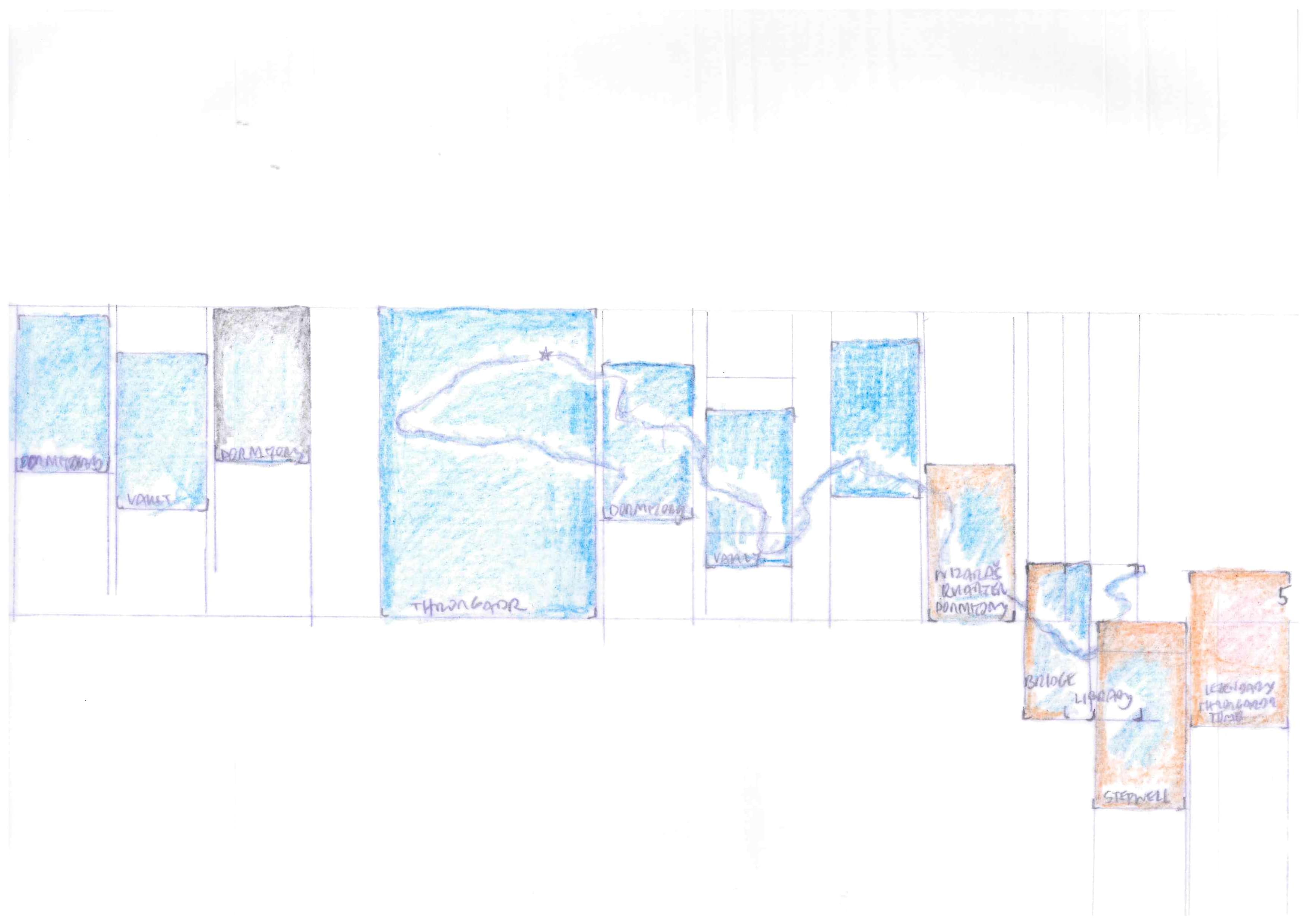
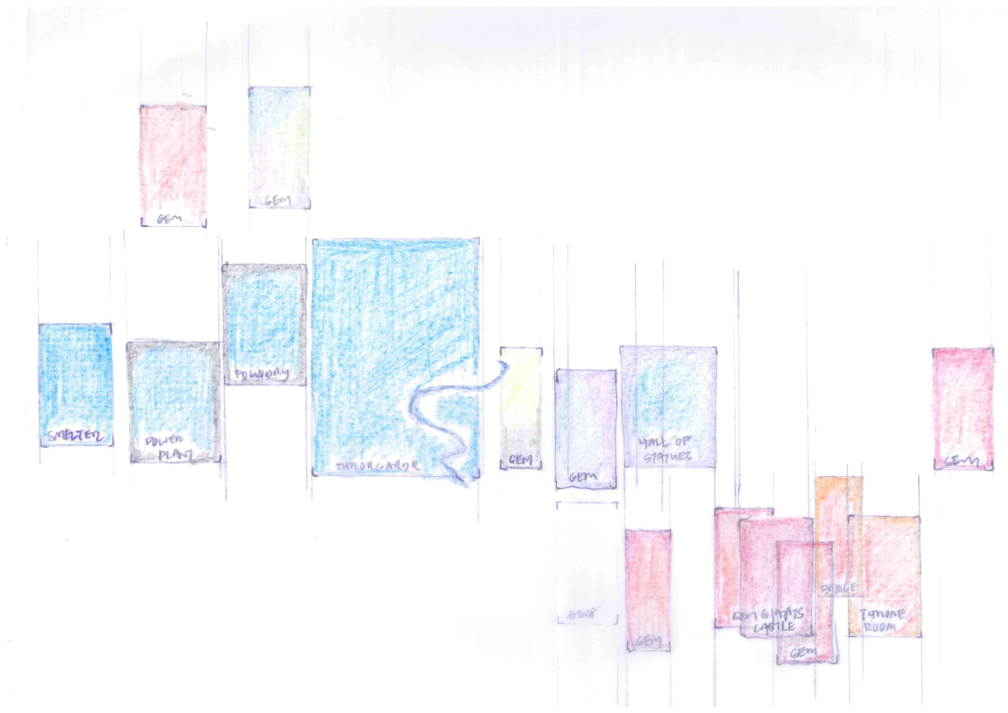
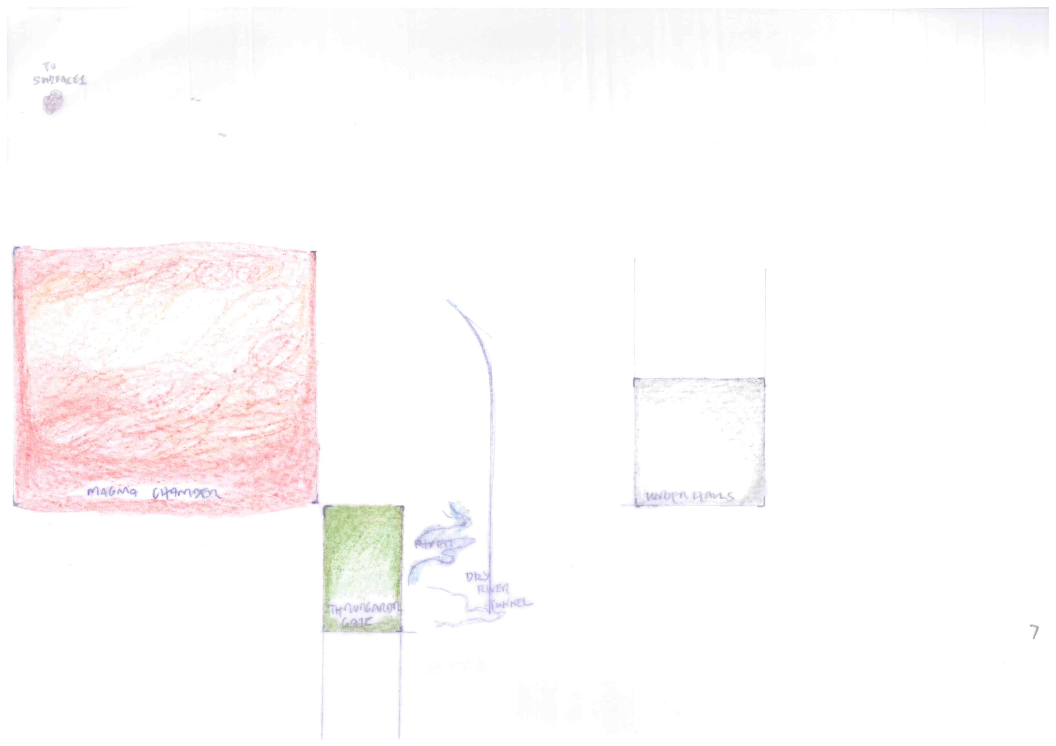
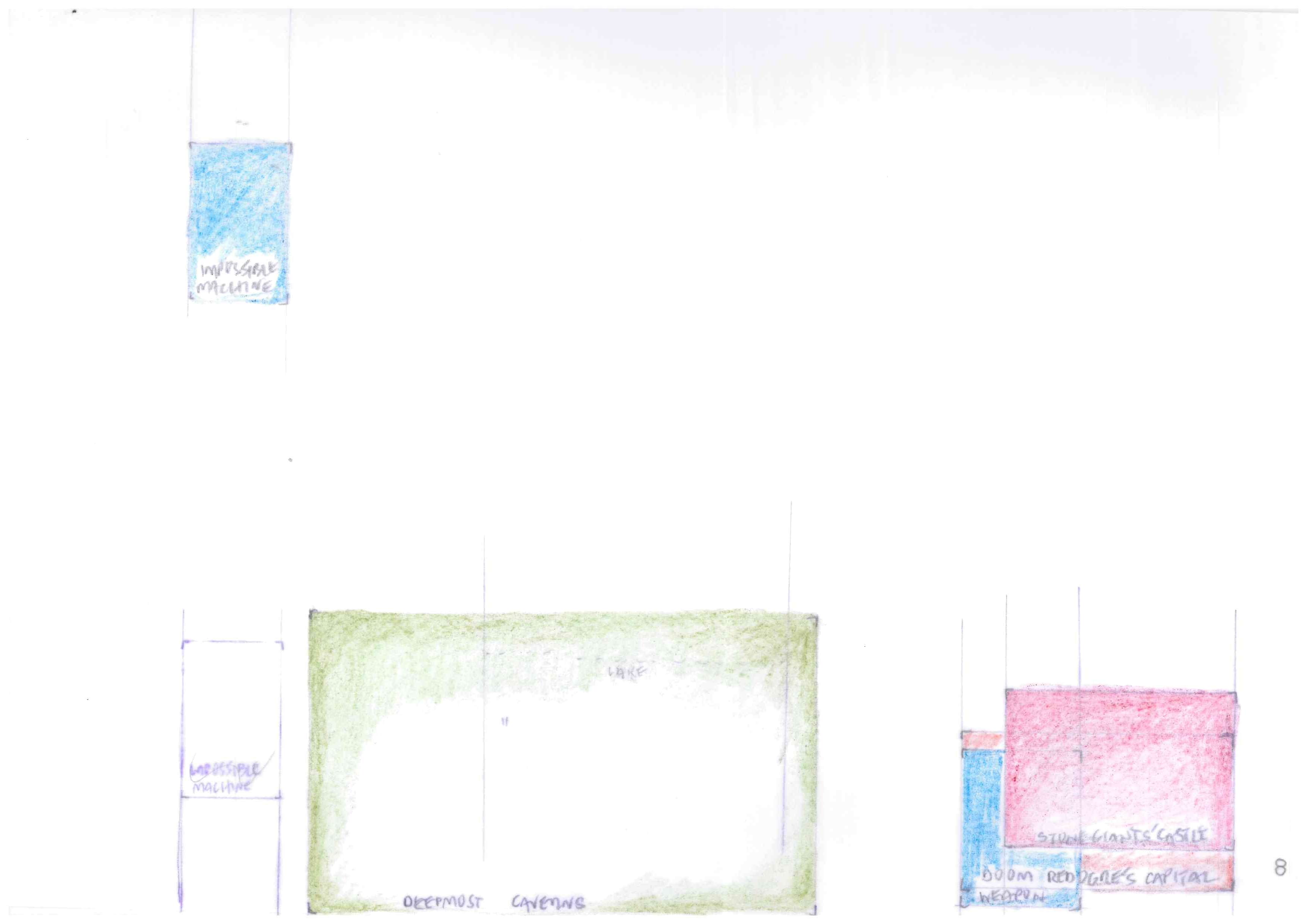
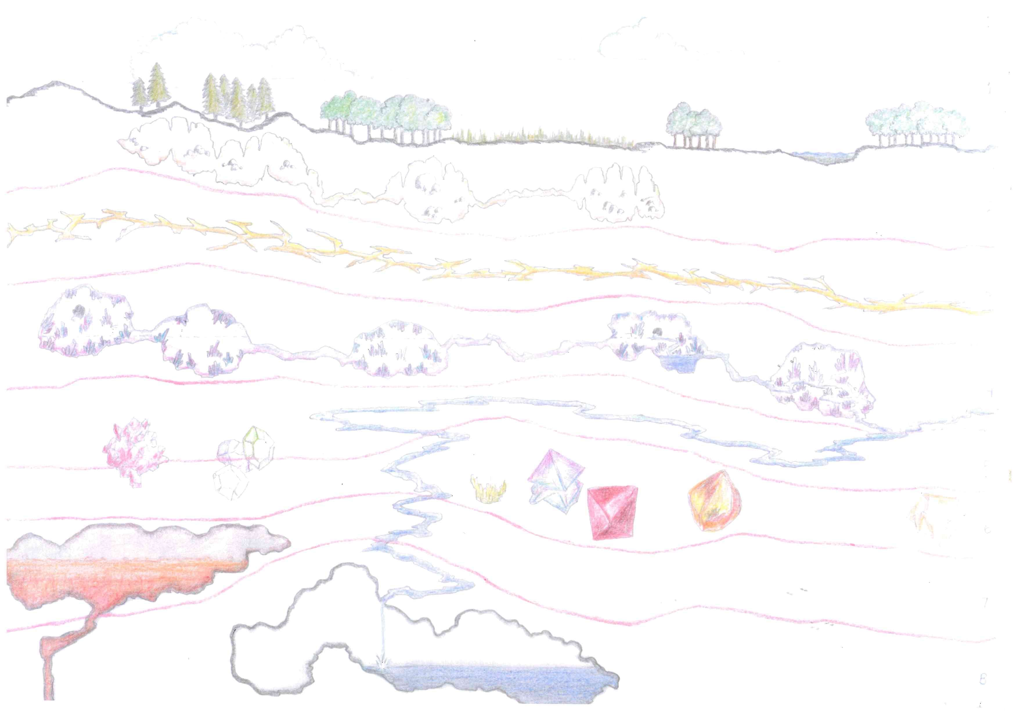
Transitioning from How to Host a Dungeon to D&D, strata become dungeon levels and rooms become areas, which are collections of natural caves or dungeon chambers. I placed each area on separate overhead maps by level. The rectangles show the general location of each area, color coded as per the cross-section maps.
Connecting Corridors
At two miles per inch, each level map covers an area 15 by 23 miles. Even areas in close proximity to each other are separated by a third of a mile or nearly 600 yards. If we allow travel along connecting corridors at the wilderness rate (where movement is measured in yards), metal-armored adventurers traverse the distance in ten turns, which, with rests, is two hours.
Not rare, though, are areas separated by a mile or four. No mere jaunt, a delve into the Throrgrmir dungeon is an expedition.
I’ve never been much for dungeon adventures lasting more than a single day. That adventurers might hunker down in a cold, damp, dangerous place—no matter how empty the room—and get several hours’ sleep to regain spells strains plausibility. That they might “do nothing but rest” (B19) for 24 hours straight to restore hit points even more so.
On the other hand, “Throrgrmir is a vast underground realm,” as Eskilsson writes. Civilizations and empires have spent countless cozy nights within its confines. With a little thought, we ought to be able to accommodate explorers on long underground forays. Furthermore, the constraint may serve to further develop the setting. Following are a few considerations.
Wandering Monsters
The long corridors may be patrolled by local denizens or imperial troops. But, as a general rule, fewer monsters wander in the connecting corridors. We might check for wandering monsters once per hour.2
Movement
Mentioned above, a party may move along connecting corridors at the wilderness rate. Generally straight passages, with few turns and hardly an intersection, give little reason to tarry. Apart from lurkers and well-hidden predators, most encounters will be met from the rear, if some creature overtakes the party, or, more likely, from the front.
Again, infrequent wanderers is a general rule. Particular corridors may break it. A party may chose to move at dungeon or wilderness speed, switching between as deemed necessary.
Dungeon Marks
The dwarf builders carved distance3 and destination in corner stones at the entrances to connecting corridors. Some of these stone blocks have been defaced. Other builders, denizens, and explorers left similar information, sometimes carved in blocks, sometimes with less durable means. Faded chalk marks are not uncommon. Whatever the media, these signs are called “dungeon marks.” Sometimes the information is correct.
Burden of Treasure
If spells and hit points are husbanded, a party may well become loaded with treasure within a score of turns.
“If the DM permits it, mules may be taken into dungeons” (B39).
A pack animal permits the acquisition of 4000 additional coins.
Trading Outposts
Traders (B43) often set up outposts near first level entrances to the lower levels. Treat an outpost as a trader lair. Traders may be accompanied by mules in the dungeon as in the wilderness. In addition to goods needed by dungeon denizens, traders deal in weapons, armor, and adventuring equipment. Outposts are established on high-traffic routes in defensible positions and are appropriately guarded.
Overnight in the Dungeon
Way Stations
Dwarf-built stretches of the connecting corridors are often punctuated with bypasses, alcoves, or the odd room or two. In some of these, the Sadhakarani nomads established way stations. Since the nomads’ recent eradication by the Red Ogre, it remains to be seen whether the stations will be maintained.
“Wandering Monsters… should not be frequent if the party spends a long time in one out-of-the-way place (if they stop in a room for the night, for example)” (B53).
Let’s say, one check per night or three checks per day (one every eight hours) while so resting at a way station or other such place, including in a remote room of a dungeon area.
Throrgrmir Enclave
Dwarves maintain an enclave in an old dormitory on the second level. From this base, they explore the dungeon, searching for Throrgrmir relics. Law-abiding persons are welcome to stay, for a price, in a boarding house, provided they make no trouble and stay out of the dwarves’ way and their business. Here, a party may rest to regain spells and recover hit points with little chance for interruption.
Sixth Cairn Protectorate
The Red Ogre recently established a “protectorate” in the former drinking hall below Troelsvollr. Governed by a Lord Protector and guarded by imperial troops, it aspires to become a city.
Notes
1 Eskilsson overestimates. The dungeon’s footprint covers 345 square miles. On the other hand, if we multiply by eight levels and assume one-fifth of the area is explorable dungeon (as opposed to solid rock), we arrive at a figure not far from the historian’s mark.
2 Within dungeon areas, normal chances for wandering monsters apply.
3 Throrgrmir dwarves measure distance in the length of their standard stone block. A dwarven “standard” is roughly equal to five feet.
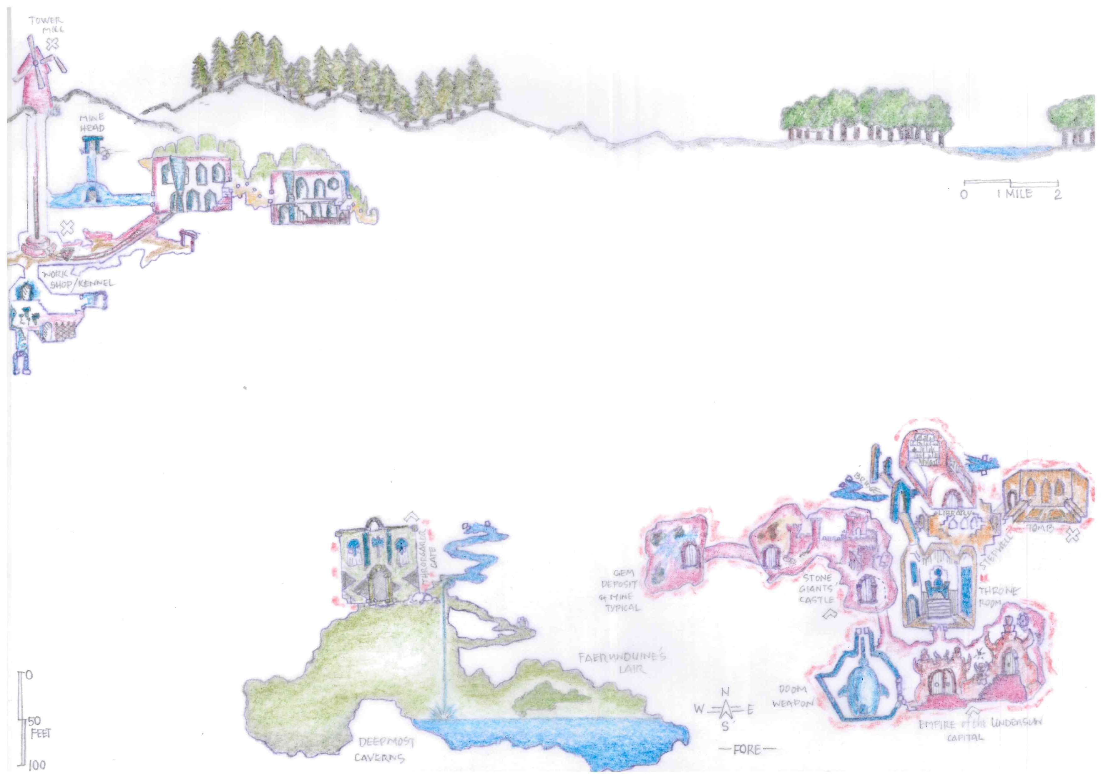
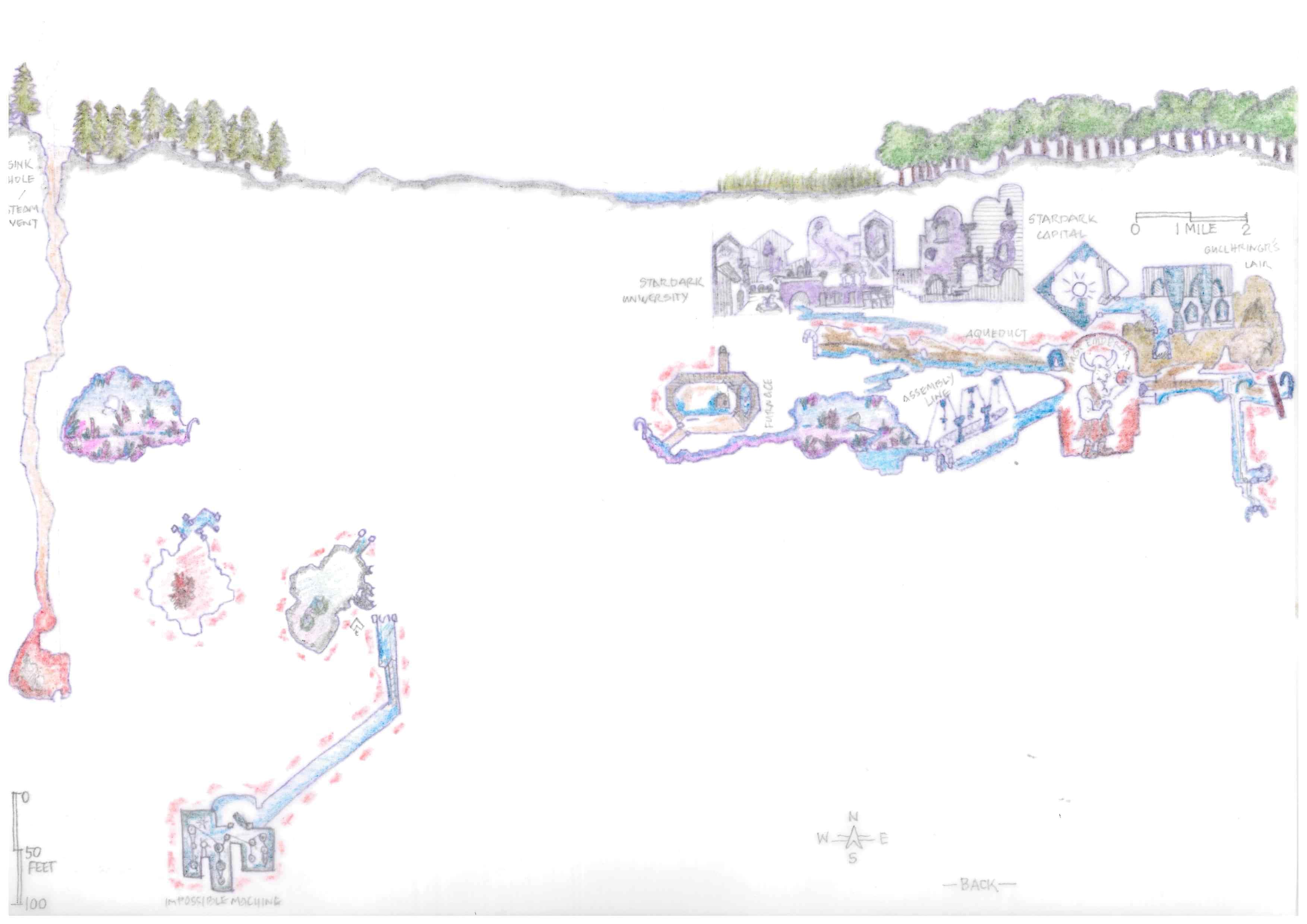
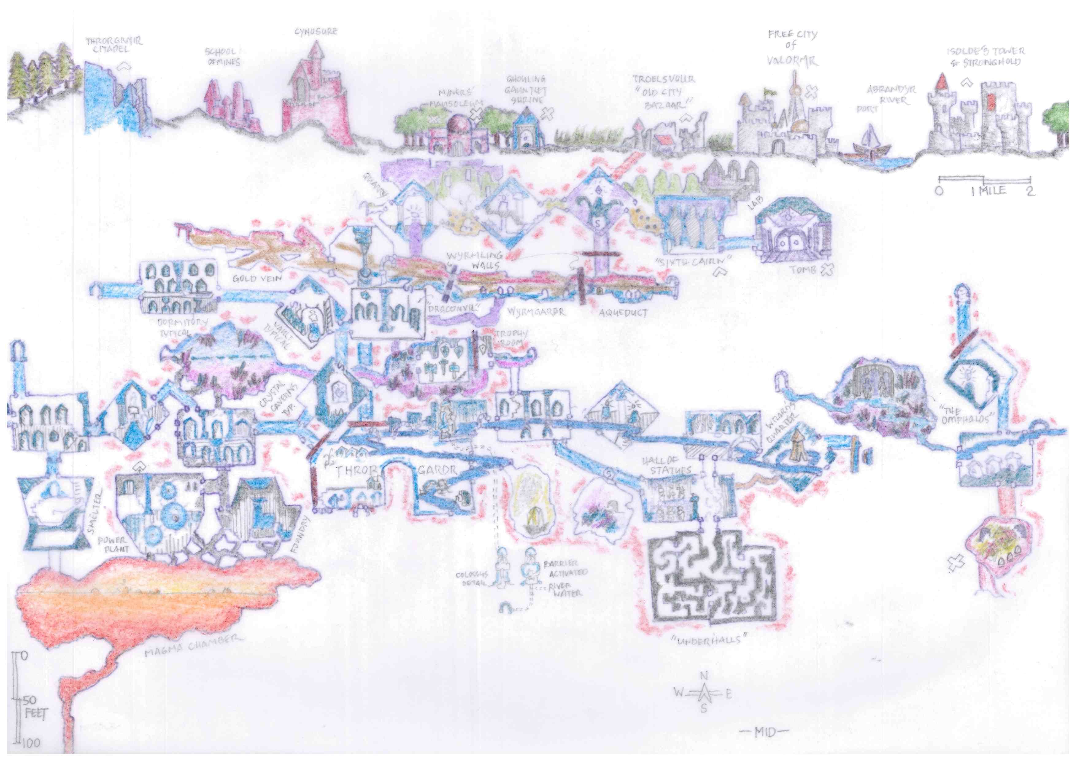
The Wyrm Dawn campaign produced a base map in the Primordial Age plus six transparent overlays in subsequent Ages. I compiled these chronological maps into a composite. In order to clear the clutter, I divided the final cross-section into middle, fore-, and background maps.
Color Code
Each room is colored to indicate its builder or initial occupant and any group which may have modified it as well as its current occupant. Following are the groups having significant impact on the dungeon’s history.
Blue Wizard
Faerunduine
Gullhringr
Kobolds
Legendary Throrgardr
Magnate
Murtax
Red Ogre
Stardark
Stone Giants
Throrgrmir Dwarves
The territory claimed by the Red Ogre is outlined in red. Imperial troops patrol these areas.
A Conundrum of Scale
When thinking of a dungeon—even a “mega-dungeon” in new school parlance—we generally consider a sheet or two of graph paper per level. At 10 or 20 feet per square, the widest dungeon level might be a couple thousand feet in width. Although the levels may be staggered—not stacked one atop another, the entire footprint fits under a surface ruin or a city.
In How to Host a Dungeon, though, you might have one or two cities among many other surface features stretched above the dungeon’s width. Looking at Wyrm Dawn’s middle ground cross-section, for example, we have two cities, Valormr and Troelsvollr, in addition to a tower and stronghold, mausoleum, shrine, the School of Mines, and the Cynosure, which was the Magnate’s capital, with a river running through it all. In my mind’s eye, the surface map spans at least a couple dozen miles. Such a scale makes the dungeon below likewise lengthy and its lowest level sixteen miles deep.
One might solve the conundrum in a number of ways. I choose to keep the horizontal scale and reduce the vertical. Keep in mind that the rooms shown on the cross-section maps serve as icons to mark a general location.
Horizontal Scale
At two miles to the inch, it’s four miles from Valormr to the ruins of Troelsvollr, in which the Old City Bazaar is set up. The nearest known entrance to the dungeon is also in Troelsvollr. Four miles is a fair morning’s travel for merchants by horse-drawn wagon as well as for adventurers on foot.
Vertical Scale
Scaling the East Tower to the cross-section of the Haunted Keep (B58), we find a scale of 100 feet to the inch in Moldvay’s dungeon example. The first dungeon level is 65 feet, the second 120, and the third 280 feet deep.
In the D&D campaign, Wyrm Dawn’s strata become dungeon levels, of which there are eight. This corresponds to the B/X Wandering Monster tables. Surface level ruins, cellars, and basements are considered as the first dungeon level.
Applying 100 feet per inch, our dungeon levels are separated by an average of 100 feet. Though longer flights often separate levels, there may be short flights of stairs up and stairs down within a given dungeon level. So, stairs down don’t always mean tougher monsters. Clever adventurers keep track of their depth to know what level they are on. When in doubt, they might also note, in natural caverns or wherever the geology is exposed, the type and color of the rock. Comparing this information to known strata indicates depth.