“The basic campaign area… was originally drawn from some old Dutch maps.”
—Dave Arneson, First Fantasy Campaign, 11
Like many Blackmoor fans, I’ve often wondered about—and long sought—these “old Dutch maps.” It isn’t surprising that the naval wargamer would have on hand maps made by one of the great maritime powers of the Age of Sail. But would these Dutch maps depict the homeland or some distant discovery, like the Falklands or the Hudson Valley?1, 2
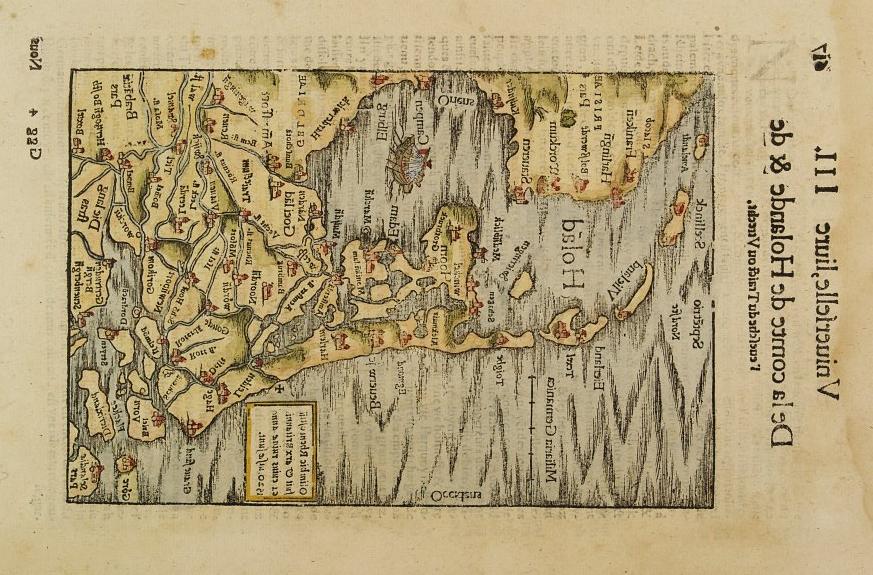
Yet, Blackmoor has in common with the Low Countries at least its soggy biome. In 2009, James Mishler of Adventures in Gaming took a 1520 map of Holland, flipped it over vertically, and rotated it 90 degrees to the left.3 He invites us to compare the results to the earliest then-known sketch map of Blackmoor, which is found in First Fantasy Campaign (12).
Mishler also notes that the image manipulation places any page footer text to the left of the map, that is, westward. Apocryphal or no, the legend goes that the Duchy of Ten, west of Lake Gloomy, is named after a “10” on the map. This, as Mishler postulates, might mean we should be looking for a map from a book that uses intaglio plates, the reverse side of which are blank.
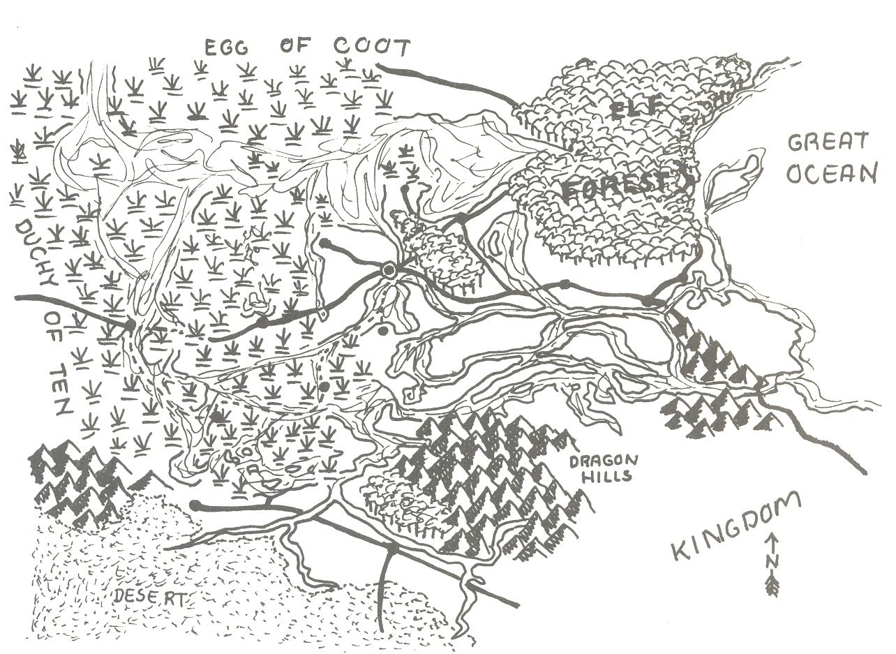
Frankly, I can make the Blackmoor sketch look like just about anywhere if I squint just right.
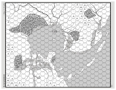
To wrap up a multi-part review of First Fantasy Campaign, Bat in the Attic Rob Conley searched out an old Dutch map to dress up as a fantasy realm. But, he writes, “I couldn't quite figure out which old Dutch map to use or how it looked anything like Blackmoor.” Finally, Conley used Mishler’s method to create the map for his Blackmarsh old-school setting supplement.4
Not satisfied with the results obtained from the Mishler method, I continued the search for “old Dutch maps.” As often happens during these rabbit-hole explorations, I learned lots of things—one of many reasons D&D is a superior game.
Having heard the legend of the little Dutch boy who plugged with his thumb a leaking dike, most of us are aware that the Netherlands has been sinking into the North Sea for centuries. Since the middle ages, the inhabitants have drained lakes to reclaim land, and an extensive engineering project called the Zuiderzee Works, in the 20th century, damned the central bay and created a number of polders.5
The practical upshot of all this is that not all old Dutch maps look the same. As man struggles against nature, land creeps above the waterline then slips below, year by year, as though subjected to the crests and troughs of a long-period tide.
Since Mishler’s go at matching Blackmoor to Holland, an earlier Blackmoor map surfaced. Most online references point to an article on Secrets of Blackmoor, which shows a colored version of what it calls the “Original Blackmoor Map.” The map is accompanied by a one-page document describing a “medieval project.”6 The document’s first enumeration reads as follows:
“See the enclosed map which represents the area known as the Northern Marches which guard the frontier of the great Empire of Geneva from the ever present threats presented by those who lurk beyond the light of our great empire and its great king.”
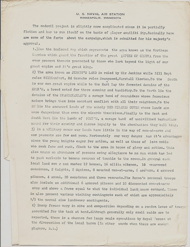
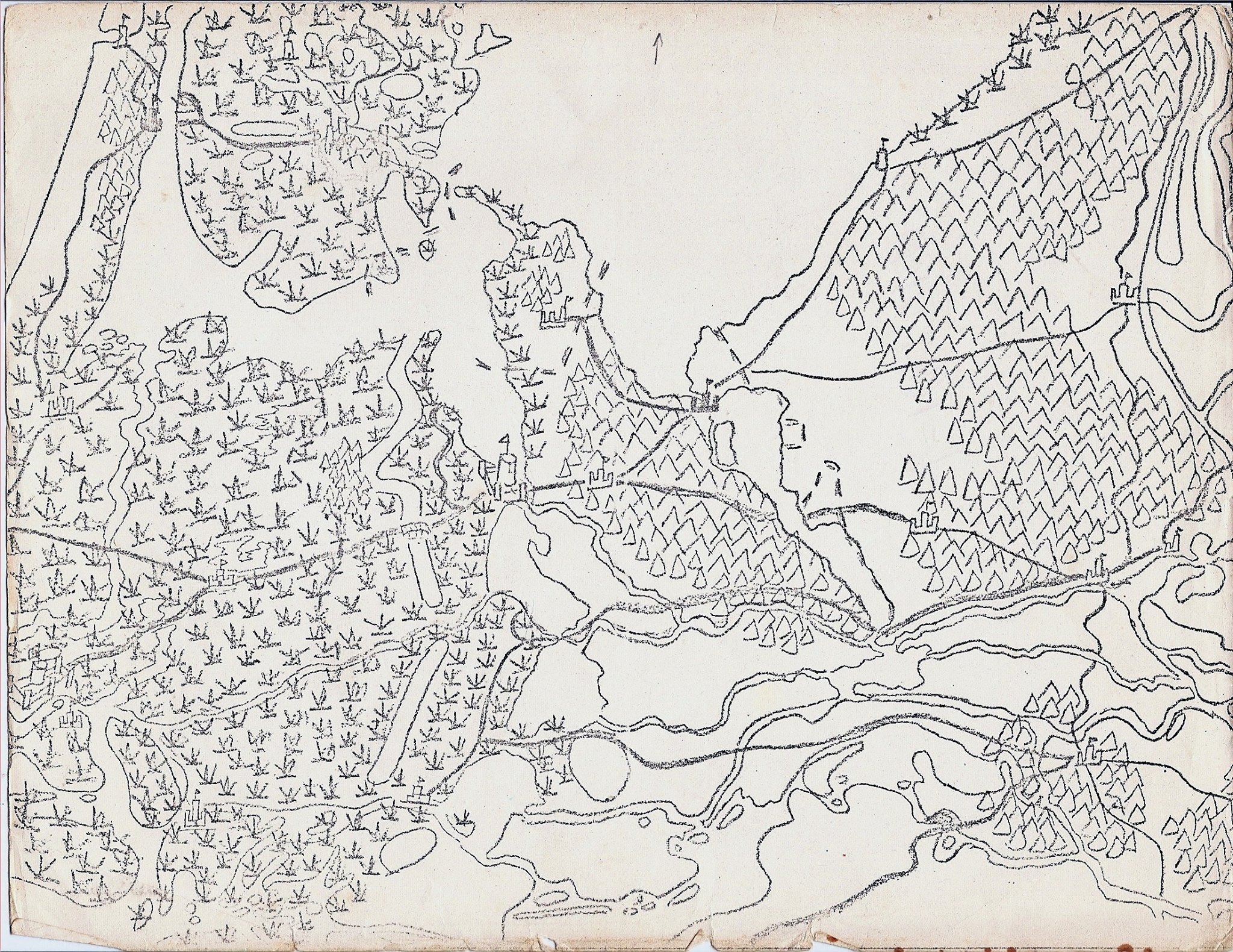
Stamps (not shown above), presumably placed by Secrets of Blackmoor, on both document and map credit the source as Twin City gamer and Arneson contemporary William Hoyt. The document’s text concludes with the initials “D.A.”
OSR Grimoire compares this earlier map to Mishler’s 1520 Holland map without alteration.
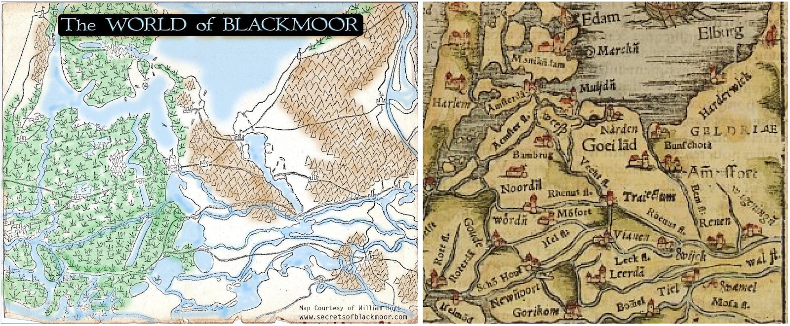
The U-shaped coastline matches up fairly well, the extreme west coast, though short, matches better, the Dutch location looks fearsome enough to accommodate the Egg of Coot, and a few Dutch roads share a similar angle as some Blackmoor waterways.
Still, though, I’m not convinced. The search continued until I saw the finger.
A salient feature of the earlier Blackmoor map, reproduced on the foldout map in First Fantasy Campaign, is a strip of land that extends from the Glendower peninsula, pointing northwest toward the Egg of Coot. I always thought Dave must be giving someone the finger—I don’t know who…
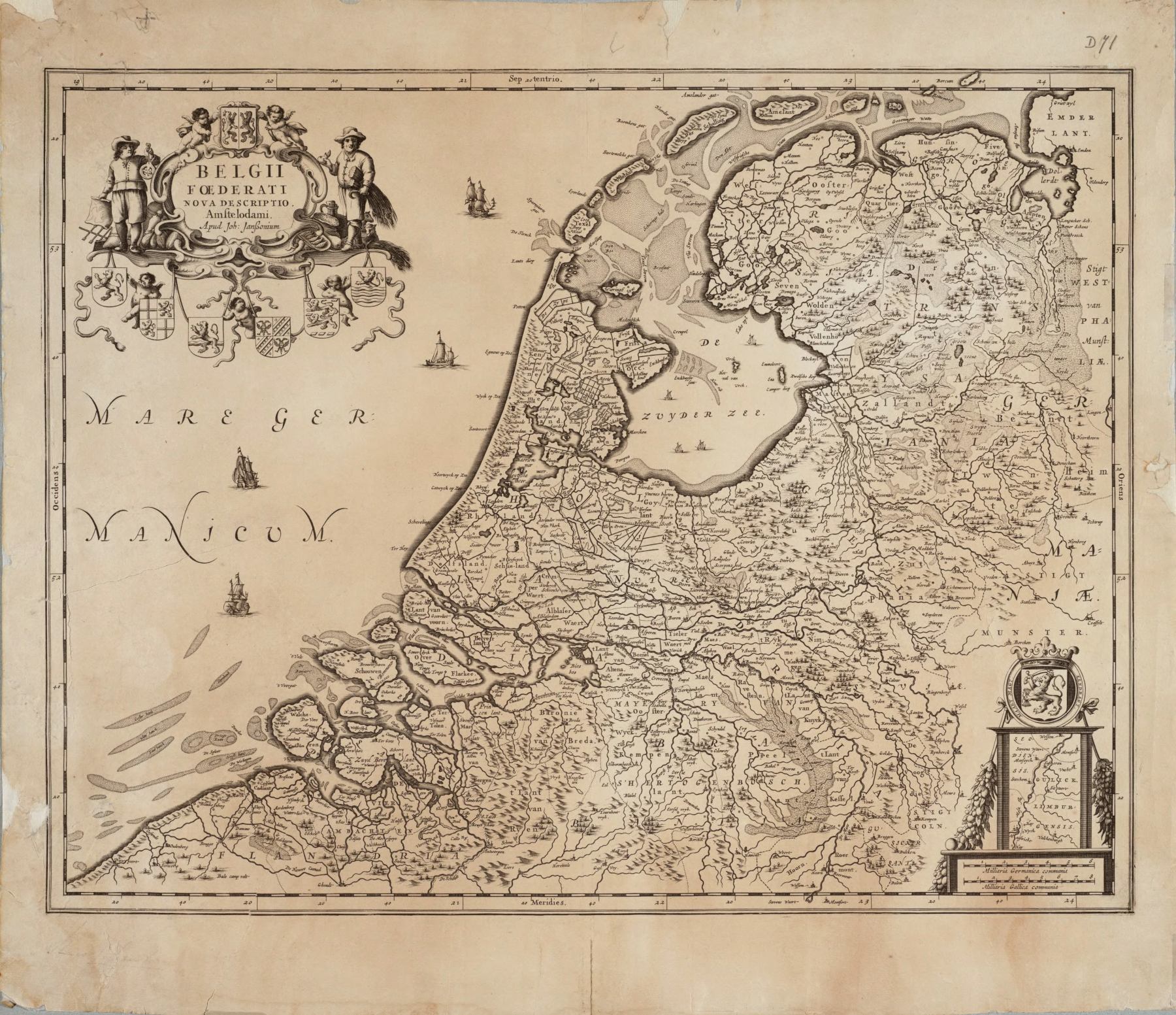
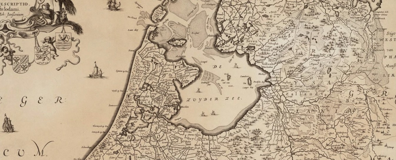
This 1658 Map of the Republic of the Seven United Netherlands7 (above) shows a similar land mass, perhaps a tidal flat (upper middle). Considering the fist behind, it is pointed the opposite direction. Applying the Mishler method, however, orients the finger to align with that of the earlier Blackmoor map. The fist becomes the Glendower peninsula.
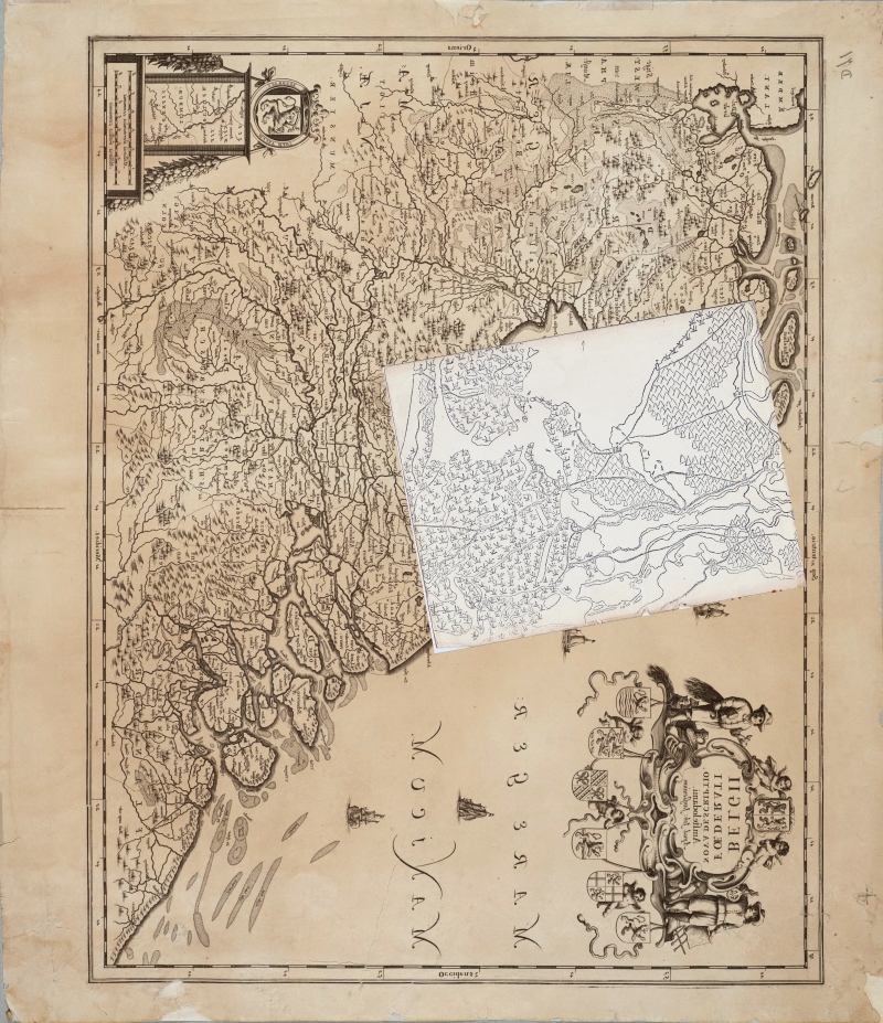
To align the finger just right, I rotated the Blackmoor map 10.29 degrees. I note also that, on importing the Blackmoor map, I didn’t have to change the scale. Coincidence, perhaps.
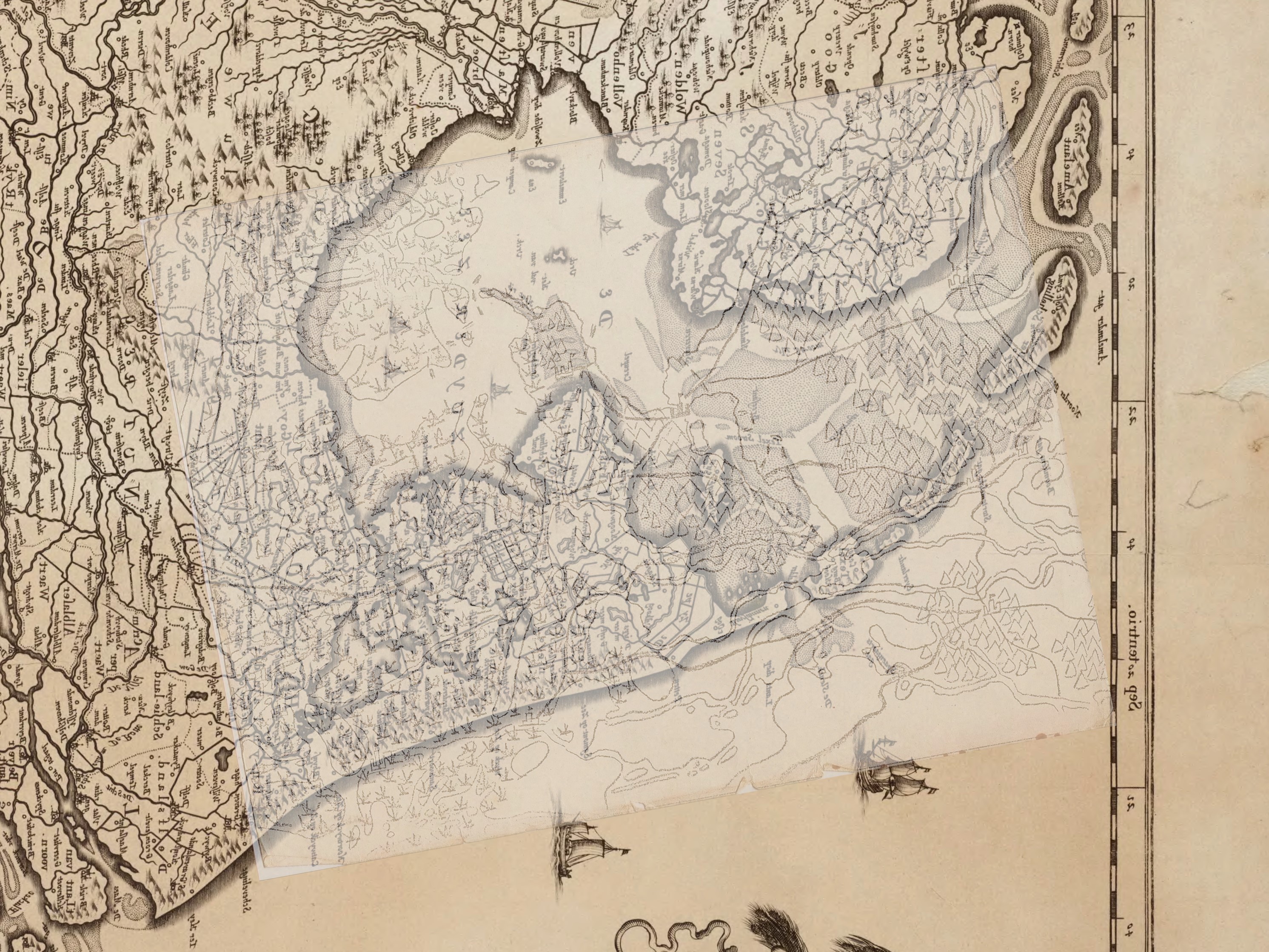
The finger of land aligns well, but nothing else matches. Maybe the Blackmoor map is an amalgam of different takes on the same or several maps.
I am yet far from convinced. But a coincidence of geography seems unlikely. Arneson may well have traced features on the reverse of a “Plate 10.” Future searches for “old Dutch maps” might keep an eye out for those showing the Blackmoor finger.
Notes
1 A thread on the OD&D Discussion forum bounces around the idea that Arneson may have been inspired by the Minnesota coast of Lake Superior.
2 Browse a few dozen old Dutch maps on Stanford’s Renaissance Exploration Map Collection.
3 Mishler’s article “Original Blackmoor Maps,” no longer available at the original address, is now found at Adventures in Gaming v2 as “[Throwback Someday Post] Original Blackmoor Maps.”
4 Blackmarsh: A Setting Supplement Compatible with the Delving Deeper Rules and All Editions Based on the Original 1974 Roleplaying Game, Robert Conley, 2011. Available in print or PDF on DriveThruRPG.
5 Polders: My untrained eye spots some of these areas of reclaimed land on a satellite image.
6 In response to a question in the comments to the Secrets of Blackmoor article, Griff Morgan writes that several pairs of the map and document exist.
7 Wikimedia Commons identifies Joannes Janssonius as the cartographer of the Map of the Republic of the Seven United Netherlands from the collection Belgii Foederati Nova Descriptio, Amsterdam, 1658.
Thanks for the shout out and enjoyed your follow up to what James and I wrote.
I live in the region in the Netherlands where the original map of Blackmoor was based on. To me as a local the OSR Grimoire seems actually very convicing when it compares the map with the part of the Netherlands they show on the Misler map. There are several features on the Blackmoor map that are recognizable.
It’s not on the Misler map but the mountain range between Vestfold and Blackmoor is exactly where and with similar shape in the Netherlands hills are located (Utrechtse Heuvelrug).
The same goes for the mountains east of Blackmoor called Elven Wood, where we have a national park of forested hills (Hoge Veluwe).
The marshy region around Lake Gloomy is also very marshy in the real Netherlands.
The locations of several castles or towns correspond with the location of Dutch cities: The Egg of Coot is Amsterdam, Vestfold is Utrecht, Blackmoor perhaps Amersfoort.
And the Black Sea is where the Zuiderzee (now Ijsselmeer) used to be.
What’s funny is that, whether we flip it over and turn it sideways or just take a Dutch map straight up, the Blackmoor map bears a strong resemblance. I keep looking to match up coastlines. Quixotic.
Dan Boggs gets the northwest Blackmoor coast to line up with a short stretch of the Netherland’s west coast. It’s a convincing angle. http://boggswood.blogspot.com/2021/05/how-big-is-blackmoor.html
Pingback: Atlantis of the Clay – DONJON LANDS